Remote Sensing Using ENVI
These are some images captured from labs conducted using ENVI. I learned various processes of detecting and monitoring physical characteristics of a certain area as well as analyzing different imageries collected by different instruments.
 |  |  |  |
|---|---|---|---|
 |  |  |  |


Aside from 2D and 3D maps, video animation can also communicate a specific storyline or analytical discovery for viewers to see a scripted presentation of the data. During the ESRI MOOC course, I was able to create a fly through animation of a mudslide that occurred in Steelhead Haven (near Oso, WA) using ArcGIS Pro. The animation shows the direction the mudslide traveled and the houses impacted by this mudslide.

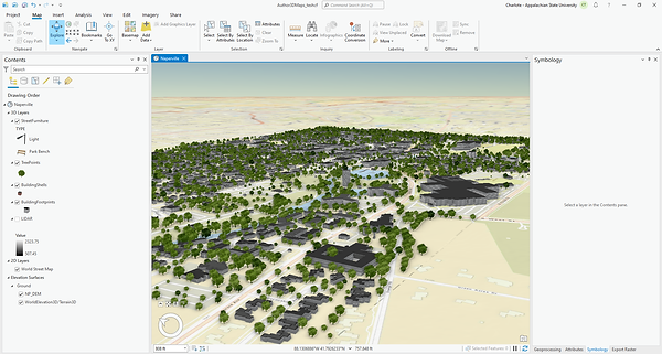
I created a thematically styled 3D city scene of Naperville, IL using ArcGIS Pro.

This is called a Spilhaus projection. This was created using ArcGIS Pro through ESRI MOOC course. It is centered on Antarctica and the worlds oceans comes together forming a single, continuous body of water. Using this projection helps visualize how connected the oceans are. It is also visually creative to see oceans together as a single unit.